






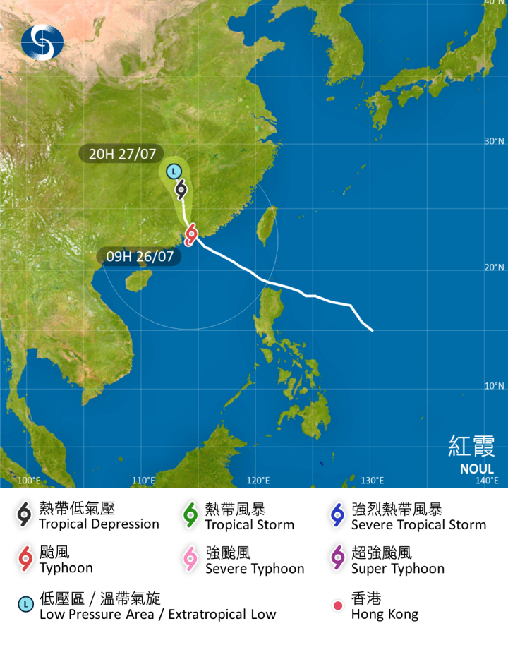
The No. 8 Southwest Gale or Storm Signal is currently in effect, as Typhoon Noul has weakened into a severe tropical storm. At 9:45 am, the Observatory stated that as Noul moves further away, local winds are expected to subside, and it will replace the current signal with the Strong Wind Signal No. 3 at 12:40 pm.
The Observatory issued the Amber Rainstorm Warning Signal at 5 am this morning and cancelled it at 10:05 am, with the warning remaining in effect for over five hours.
According to the Observatory, Noul is steadily moving into the interior of Guangdong, beginning to distance itself from Hong Kong and continuing to weaken. However, gale-force southwest winds are still affecting some offshore areas and high ground intermittently. Under the influence of the outer rainbands associated with Noul, the city will continue to experience frequent squally heavy showers and thunderstorms today. Seas will remain rough with swells. The Observatory reminded the public to remain vigilant, stay away from the shoreline, and cease all water activities.
At 10 am, Noul was centred about 90 kilometres north of the Hong Kong Observatory, near latitude 23.1 degrees north and longitude 114.3 degrees east. It is forecast to move north-northwest at about 15 kilometres per hour, moving into the interior of Guangdong and continuing to weaken. In the past hour, the maximum sustained wind speeds recorded at Waglan Island, Lau Fau Shan, and Tate's Cairn were 76, 68, and 63 kilometres per hour respectively, with maximum gusts exceeding 99, 89, and 96 kilometres per hour.
Related News:
Typhoon Noul | HKO: Hail possible in HK within next one to two hours




Comment