






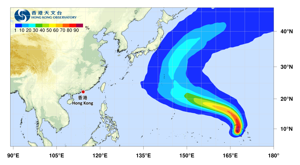
The western Pacific has once again seen three typhoons developing simultaneously as October gets underway, with Typhoon Choi-wan, the 27th named storm of the year, Typhoon Nolo, the 28th, and Typhoon Koguma, the 29th, each developing in the region.
As of Tuesday morning (Oct. 6), Choi-wan continued to weaken and is expected to transition into an extratropical cyclone soon. Nolo was also weakening, although its eye remained clearly visible. It may later move westward before turning northward. Koguma, meanwhile, was gradually strengthening and could reach super typhoon intensity, with its track expected to head northwest before turning northeast.
According to the Hong Kong Observatory's (HKO) latest track forecasts, the three typhoons are unlikely to have a direct impact on HK, although their subsequent development remains to be seen.
Meanwhile, the northeast monsoon is affecting Guangdong. The HKO recorded a minimum temperature of 23.3°C on Tuesday morning, the lowest temperature recorded in HK since the start of autumn this year.
The Observatory forecast that the dry northeast monsoon would bring generally fine weather to the coast of Guangdong over the next one to two days, with relatively strong winds in the region.
The monsoon is expected to weaken slightly from around the weekend to early next week. Under the influence of an upper-air anticyclone, generally sunny weather is expected across Guangdong, with temperatures gradually rising.
The temperature difference between day and night is expected to be relatively large in inland areas.
Related News:




Comment