






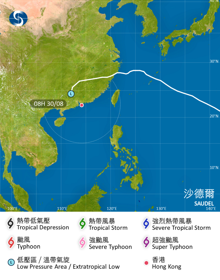
The remnants of Typhoon Saudel may make a comeback, with the Hong Kong Observatory (HKO) considering the issuance of the No. 1 Standby Signal as the system approaches the region.
According to the latest update, the remnants of Saudel's circulation may merge with a tropical disturbance over the South China Sea on Monday (Aug. 31), before turning east-northeastward and potentially developing into a tropical depression or a numbered tropical cyclone.
The HKO said it would consider issuing the No. 1 Standby Signal depending on the system's development and its distance from HK.
The Observatory forecast that there would be more frequent showers in parts of HK, along with strong winds and thunderstorms, on Tuesday (Sept. 1), the first day of the new school year. The public was advised to check the Observatory's latest weather updates before heading to school or work.
The Observatory expects the low-pressure system to move across the northern part of the South China Sea from Tuesday to Wednesday (Sept. 1 and 2), gradually approaching the eastern coast of Guangdong.
Under the combined influence of the system and the northeast monsoon, winds in HK are expected to strengthen from Tuesday daytime through Wednesday.
The Observatory said it would closely monitor the system's movement and changes in local wind conditions to assess whether a higher tropical cyclone warning signal would be necessary.
Related News:
Typhoon Saudel enters 800km range of HK, tropical cyclone warning unlikely: Observatory




Comment