






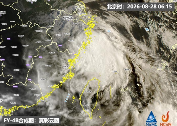
Typhoon Saudel, the 18th typhoon of the year, made its second landfall in Zhejiang Province on Friday morning (Aug. 28), while Hong Kong is expected to see a few showers and isolated thunderstorms.
According to the Zhejiang meteorological service, the center of Typhoon Saudel, classified as a typhoon-level storm, made its second landfall along the coast of Longwan District in Wenzhou at around 9:10 a.m. on Aug. 28.
The storm had maximum sustained winds of 12 on the Beaufort scale, or 33 meters per second, near its center at the time of landfall, with a minimum central pressure of 978 hectopascals.
The Hong Kong Observatory (HKO) said at 9:45 a.m. that showers associated with a broad trough of low pressure and the southwesterly monsoon were affecting the coast of Guangdong.
At 10 a.m., Typhoon Saudel was located about 30 kilometers east-northeast of Wenzhou. It was forecast to move westward at about 22 kilometers per hour, crossing southern Zhejiang before moving inland.
The HKO forecast that HK would be generally cloudy on Friday, with a few showers and isolated thunderstorms. There would be sunny intervals and hot conditions for brief periods during the day, with moderate westerly to southwesterly winds.
A few showers will persist on Saturday, with very hot conditions during the day. The weather will remain unsettled on Sunday.
Showers are expected to gradually ease from early to mid-next week, with improving weather conditions.
Related News:
HKO: Rainstorm area affecting HK, heavy rain expected early on




Comment