


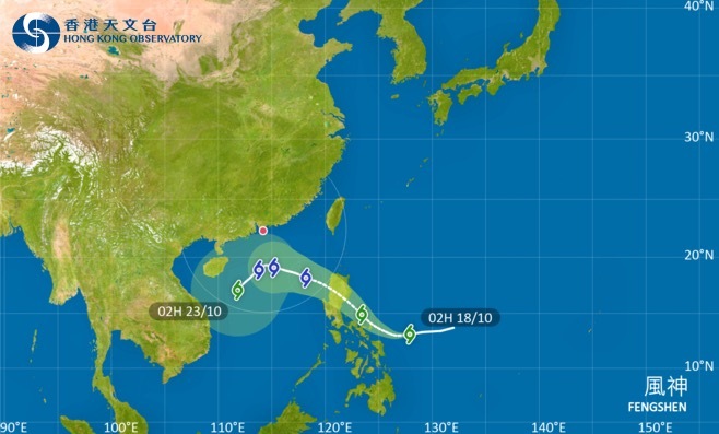
The Hong Kong Observatory (HKO) announced on Oct. 17 that a strong northeast monsoon will reach the coastal areas of Guangdong Province this Sunday (Oct. 19). As the circulation of a tropical cyclone gradually affects the region, the Observatory may directly issue the Strong Wind Signal No. 3, bypassing the Standby Signal No. 1 typically issued first.
According to the HKO, the combined effects of the monsoon and the tropical cyclone are expected to bring persistently strong winds and increasingly cloudy and rainy weather in the following days. By midweek, urban temperatures are forecast to drop significantly to around 20°C, with temperatures in the New Territories falling another two to three degrees lower.
From this weekend to midweek next week, the weather will transition from hot to cool, marking a sharp change. Residents are advised to stay alert to this abrupt shift in weather conditions.
Related News:
Chilly winds ahead: HK may see temperatures dip below 20°C next week


Comment