


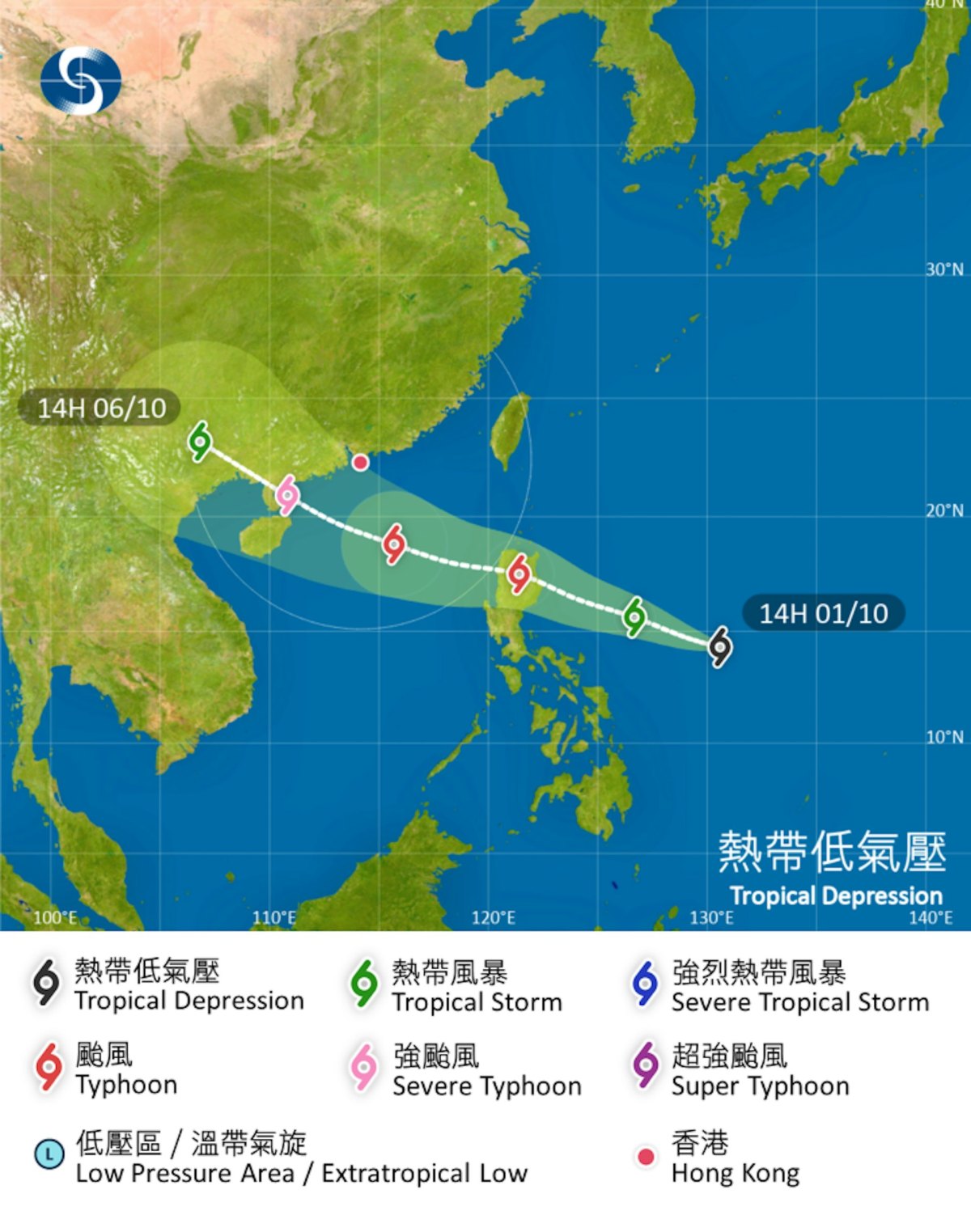
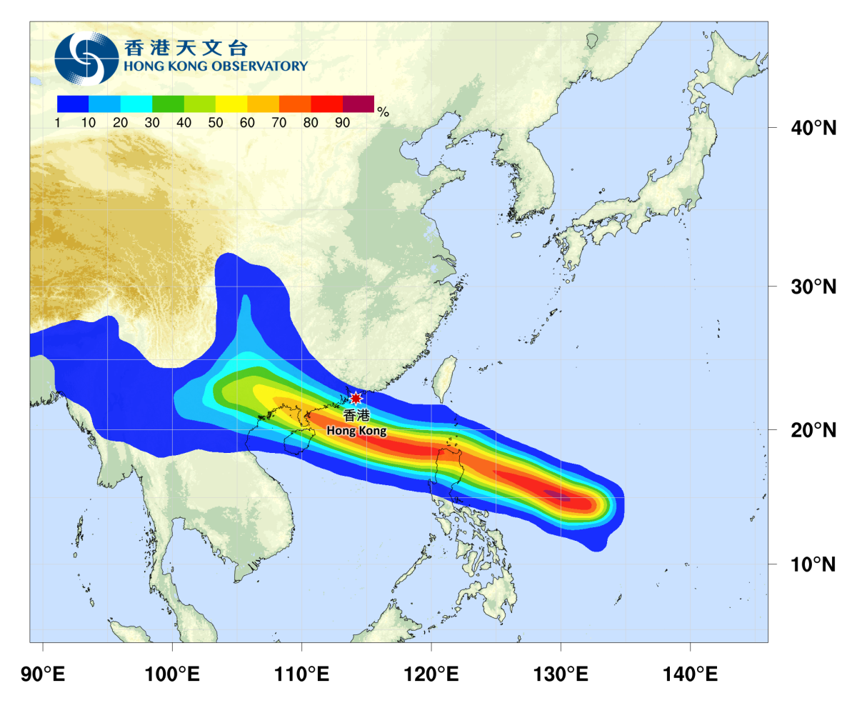
A tropical cyclone named Matmo is expected to cross the central and northern South China Sea over the weekend, with a predicted path generally toward the western coast of Guangdong and the eastern part of Hainan Island, though its intensity remains uncertain. The Hong Kong Observatory issued a forecast movement path map this afternoon (Oct. 1), indicating that the tropical cyclone is expected to enter the area 800 kilometers southeast of Hong Kong at typhoon strength on Friday (Oct. 3) evening, and will continue to strengthen.
The Observatory stated that an upper-level anticyclone is bringing generally clear and hot weather to South China. It predicts that the Hong Kong area will be partly cloudy at times tonight. Tomorrow will be mostly sunny, with a minimum temperature of around 28 degrees Celsius in the morning, and daytime temperatures becoming hot, reaching around 33 degrees Celsius in urban areas and a couple of degrees higher in the New Territories. A moderate easterly to southeasterly wind will blow. Friday will be mostly sunny and hot. From Saturday afternoon to Sunday, showers will gradually increase, with strong winds and rough seas. The weather is expected to improve gradually during the Mid-Autumn Festival and the following day.
Related News:
Airport departure tax increased to HK$200 effective immediately
Photos | Warships arrive in HK: Naval personnel engage warmly with citizens


Comment