


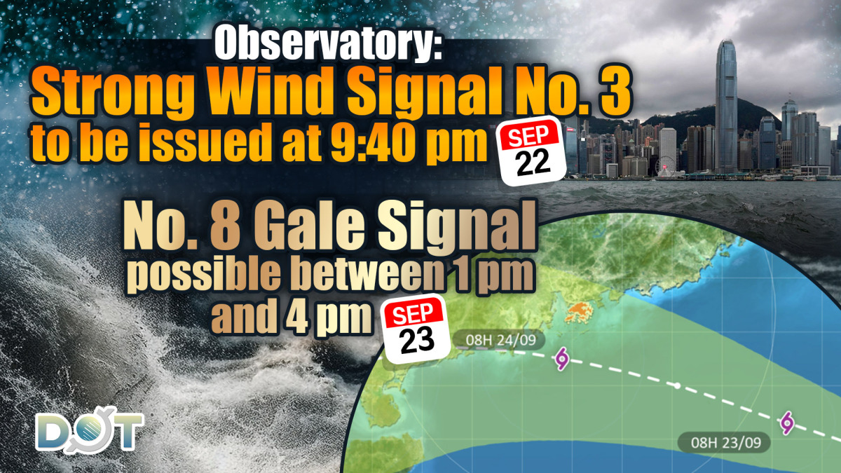
As typhoon Ragasa approaches, the Standby Signal No. 1 is currently in effect. The Hong Kong Observatory states that according to the latest forecasts, Ragasa will cross the Luzon Strait and enter the northern South China Sea today (Sept. 22). As Ragasa nears the Guangdong coast, wind conditions in Hong Kong will gradually intensify, and the Observatory will issue the Strong Wind Signal No. 3 at 9:40 pm tonight.
It is expected that the weather in Hong Kong will rapidly deteriorate tomorrow (Sept. 23) in the afternoon, and the Observatory is considering issuing the No. 8 Gale or Storm Signal between 1 pm and 4 pm. On Wednesday (Sept. 24), the severe weather will continue, with strong to gale-force winds, and offshore and elevated areas potentially experiencing hurricane conditions, accompanied by heavy squalls, thunderstorms, and very large waves. Citizens are advised to stay away from the shoreline and suspend all water activities.
Due to significant storm surges, it is anticipated that water levels along the coast of Hong Kong will increase by about 2 meters on Wednesday morning, with the highest water levels generally reaching about 3.5 to 4 meters above the chart datum, while the water level in Tolo Harbour may rise to 4 to 5 meters above the chart datum. Citizens are urged to take appropriate precautions.
Related News:
Super Typhoon Ragasa: Reports indicate HK airport considering 36-hour flight suspension


Comment