


The Hong Kong Observatory announced today (Sept. 20) that severe tropical storm Mitag has become the 10th tropical cyclone this year to trigger warning signals, setting a new record for the most signals issued between January and September since 1946.
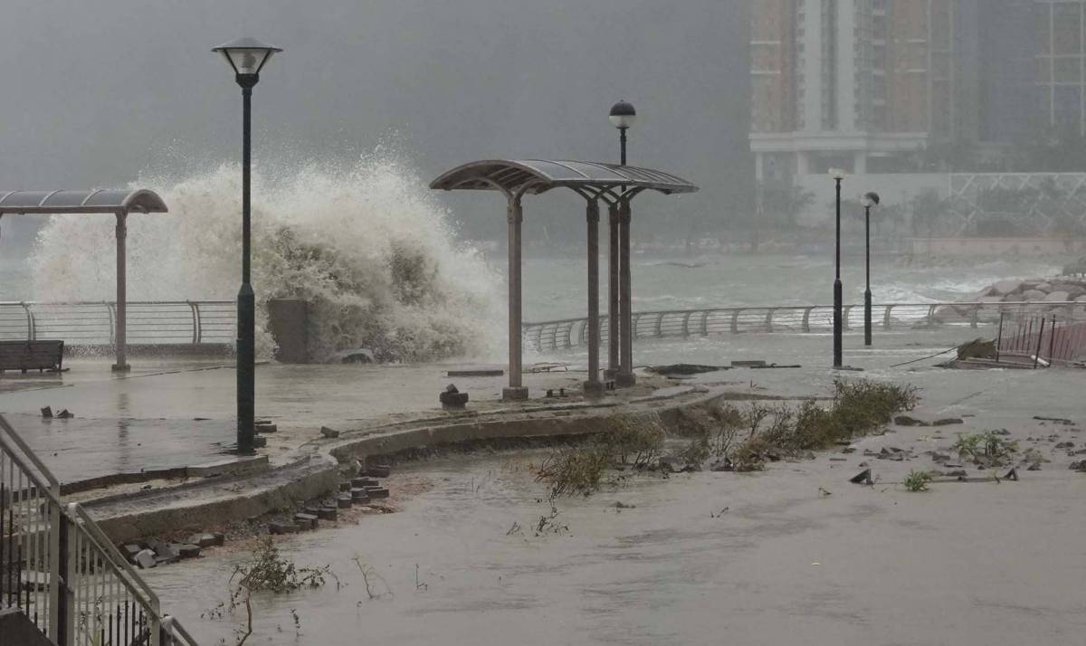
As Mitag moves away, attention is now turning to Super Typhoon Ragasa, which is expected to approach the Guangdong coastline by mid-next week. The Observatory forecasts that HK will experience deteriorating weather from Tuesday to Wednesday, with gale to storm-force winds, heavy rain, thunderstorms, and rough to high seas with large waves.
The Observatory has also warned that Ragasa could bring significant storm surges when it nears the Guangdong coast, with water levels potentially reaching heights comparable to those seen during Typhoon Hato in 2017 and Typhoon Mangkhut in 2018.
Related News:
Tropical cyclone Ragasa approaches HK, several airlines announce fee waivers
Tropical storm Mitag update: HKO downgrades Signal to NO. 1 at 9:20 am


Comment