


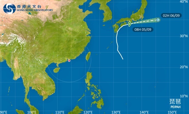
The Hong Kong Observatory (HKO) has released a special weather bulletin today (Sept. 5), indicating that a low-pressure system near Luzon, currently about 800 kilometers from HK, is expected to develop into a tropical cyclone later tonight or early tomorrow (Sept. 6). The Observatory is considering issuing Standby Signal No. 1.
The HKO noted that due to the influence of an upper-level anticyclone, HK will remain generally sunny and extremely hot tomorrow, with urban temperatures reaching around 35°C and even higher by 2-3°C in parts of the New Territories.
Current forecasts suggest that the tropical cyclone will gradually intensify over the next two to three days while tracking towards the Guangdong coast. However, uncertainties remain regarding its strength and movement speed.
The Observatory predicts that by Sunday (Sept. 7) afternoon, local winds will strengthen, and weather conditions will become increasingly unstable. On Monday (Sept. 8), strong winds, heavy rain, thunderstorms, and rough seas with swells are expected. Coastal low-lying areas may experience flooding during Monday morning due to storm surges.
The HKO will monitor the tropical cyclone's intensity, the distance of its strong wind zone from HK, and local wind conditions to assess whether a higher tropical cyclone warning signal will be issued on Sunday.
Related News:
HKO: Standby Signal No. 1 to remain until at least 9 am tomorrow
Standby Signal No. 1 to remain in force at least until 5 pm: HKO


Comment