


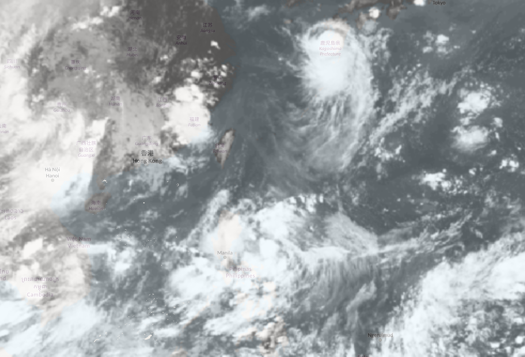
The Hong Kong Observatory announced today (Aug. 21) that a low-pressure area currently located east of the Philippines is expected to cross Luzon tomorrow (Aug. 22). Over the weekend, it is forecast to move across the central and northern parts of the South China Sea, gradually developing as it heads toward the southern part of Hainan Island and nearby waters. However, the system's intensity and trajectory in the South China Sea remain uncertain.
The Observatory predicts that the potential tropical cyclone will maintain a distance of approximately 500 kilometers or more from HK, making the likelihood of strong winds (force 8 to 9) in the city relatively low.
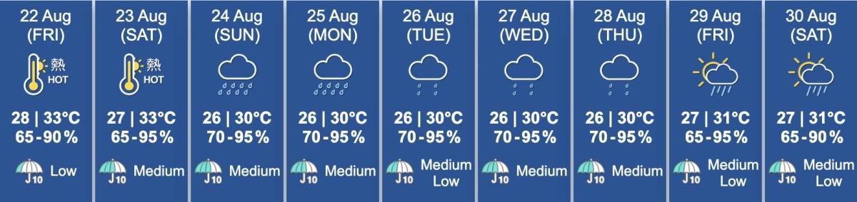
According to the Observatory's nine-day weather forecast, weather conditions may deteriorate later on Saturday (Aug. 23), with occasional squally showers and thunderstorms expected. Offshore and high-altitude areas could experience wind speeds of force 6 from Sunday to Monday (Aug. 25-26).
Related News:
No. 1 signal to remain in effect until 8 pm tonight: Assessment to determine need for No. 3 signal


Comment