


A broad area of low pressure is bringing unsettled weather to the central and northern parts of the South China Sea, and is located within 800 kilometres of Hong Kong, according to the Hong Kong Observatory.
According to the present forecast, the area of low pressure will move north in the general direction of the vicinity of Hainan Island and the coast of western Guangdong and may develop. Under the combined effect of the area of low pressure and the ridge of high pressure over southeastern China, local winds will strengthen. Depending on the local wind change, the Observatory will consider issuing the Strong Monsoon Signal.
If the area of low pressure develops into a tropical cyclone, depending on its intensity and distance from Hong Kong, the Observatory will assess the need for issuing the Tropical Cyclone Warning Signal earliest around midnight tonight (Aug. 16).
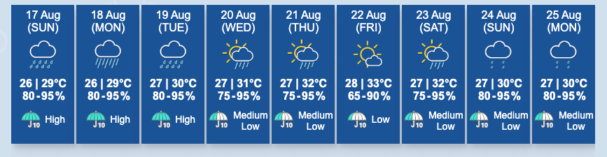
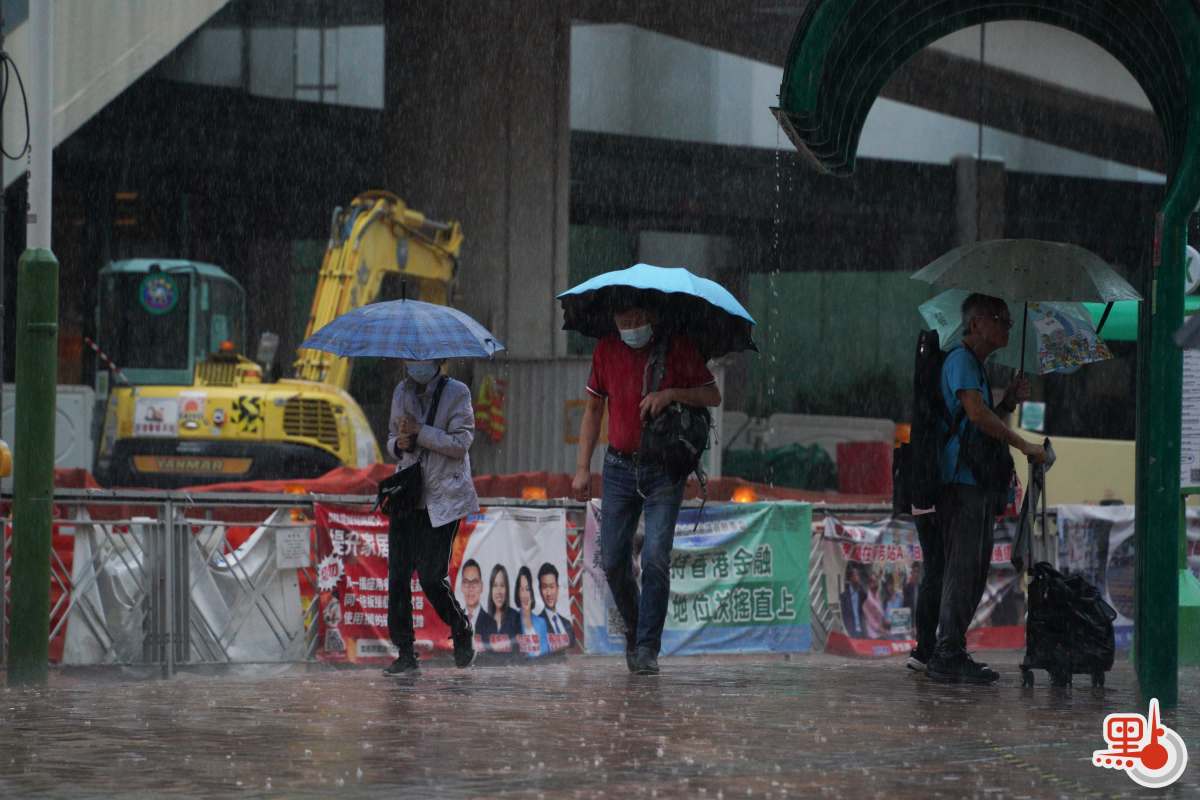
Rainbands associated with the area of low pressure have affected the coastal waters of Guangdong. With it moving northwards, squally showers will begin to affect the territory tomorrow (Aug. 17), and showers will increase gradually later.
Those engaging in water sports should be aware of the danger posed by rough seas. Showers will be heavy at times with squalls on Monday (Aug. 18) and Tuesday (Aug. 19). Members of the public should take note of the latest weather information and warning bulletins issued by the Observatory and take note of the road conditions before departing.
Related News:
Watch This | Southern District turns into 'water park': Riding bus feels like a water slide
Over 5,000 lightning strikes recorded as thunderstorm hits HK


Comment