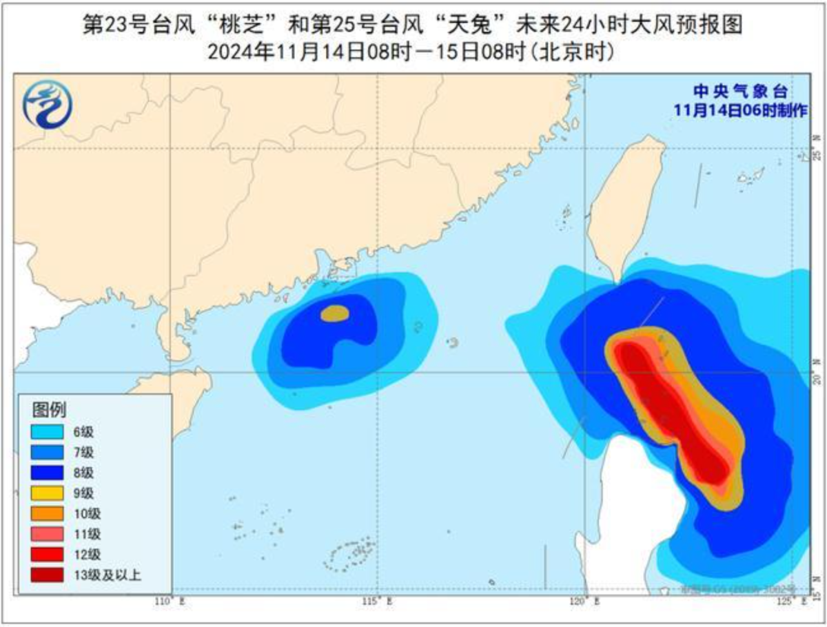
The National Meteorological Center of CMA issued a blue typhoon warning this morning (Nov. 14). The 25th typhoon of the year, Usagi, was upgraded from typhoon level to super typhoon level last night. As of 5 a.m. today, its center was located approximately 370 kilometers northeast of Manila, Philippines, with maximum wind speeds of 17 levels (58 meters per second) near the center.
The Center predicts that Typhoon Usagi will move northwest at a speed of 20 to 25 kilometers per hour, with a slight weakening in intensity. It is expected to brush past or make landfall on the northeastern coast of Luzon Island, Philippines, this afternoon. After that, it will turn and move northward, approaching the southern coast of Taiwan, with intensity gradually decreasing.
Additionally, the Hong Kong Observatory issued a No. 3 strong wind signal at 10:20 a.m. today. Typhoon Toraji is beginning to weaken and is gradually moving away from Hong Kong, with local wind strength expected to ease.
The Observatory forecasts that Toraji will cross the waters south of the Pearl River Estuary today, and under the combined influence of Toraji and the northeast monsoon, there will be strong winds and squalls along the Guangdong coast. As Toraji gradually moves away and weakens later this week, the rain will decrease, and the weather will improve.
Meanwhile, Usagi, located east of the Philippines, is expected to move toward the Luzon Strait in the next couple of days, with its path remaining variable, and it is likely to head toward waters east of Taiwan. A northeast monsoon of strong wind intensity is expected to reach the southern coast of China early next week, bringing significantly cooler weather and occasional rain in the middle of next week. At the same time, tropical cyclone Man-yi in the northwestern Pacific may enter the central and northern South China Sea early next week, leading to strong winds in those areas under the combined influence of Man-yi and the northeast monsoon.
Related News:
Typhoon Signal No. 3 issued | No flooding report as of this morning: DSD
Four typhoons? Observatory to issue Typhoon Signal No. 1 between 8:00 pm and 12:00 am


Comment