


The Hong Kong Observatory (HKO) reported today (Sept. 21) that a broad trough of low pressure over the northern part of the South China Sea is bringing showers and thunderstorms to the coast of Guangdong.
According to HKO, a low-pressure area located about 80 kilometers northeast of the HKO remains weak, with insufficient wind strength and convection to be classified as a tropical cyclone. It is forecast to move west in the general direction of the vicinity of the Pearl River Estuary to the coast of western Guangdong. As it approaches HK, some areas may experience stronger winds, accompanied by thunderstorms.
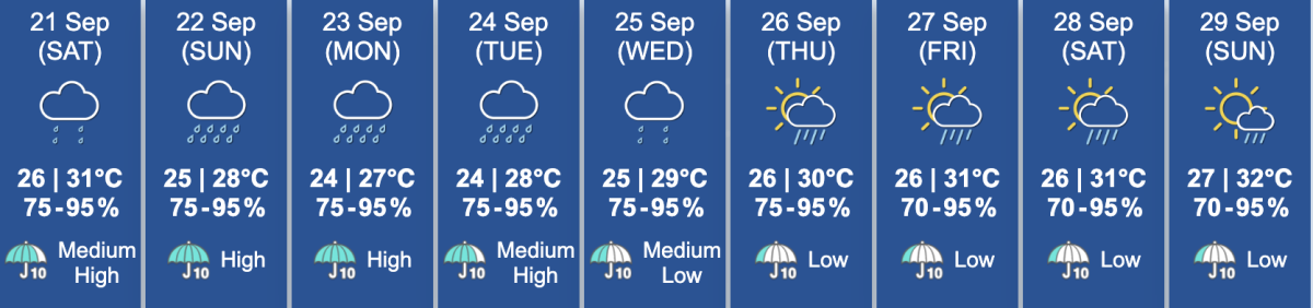
In addition, the Observatory noted that HK will be mostly cloudy today, with a few showers and squally thunderstorms.
There will be showers early next week. Showers will be more frequent at times. It will be windy and temperatures will fall progressively. The minimum temperature will be about 24 degrees in the urban areas, and a couple of degrees lower in the New Territories on Monday and Tuesday.
Related News:


Comment