






A rare weather pattern has emerged over the northwestern Pacific and the South China Sea, where four tropical cyclones are active in relatively close proximity.
Citing information from the Hong Kong Observatory (HKO), the report said Hong Kong's weather on Saturday (Aug 23) is expected to be mainly cloudy with a few showers. The forecast calls for brief sunny intervals and hot conditions during the day, with isolated thunderstorms later. The HKO outlook suggests more frequent showers and squally thunderstorms over the next two to three days and stronger winds in some districts.
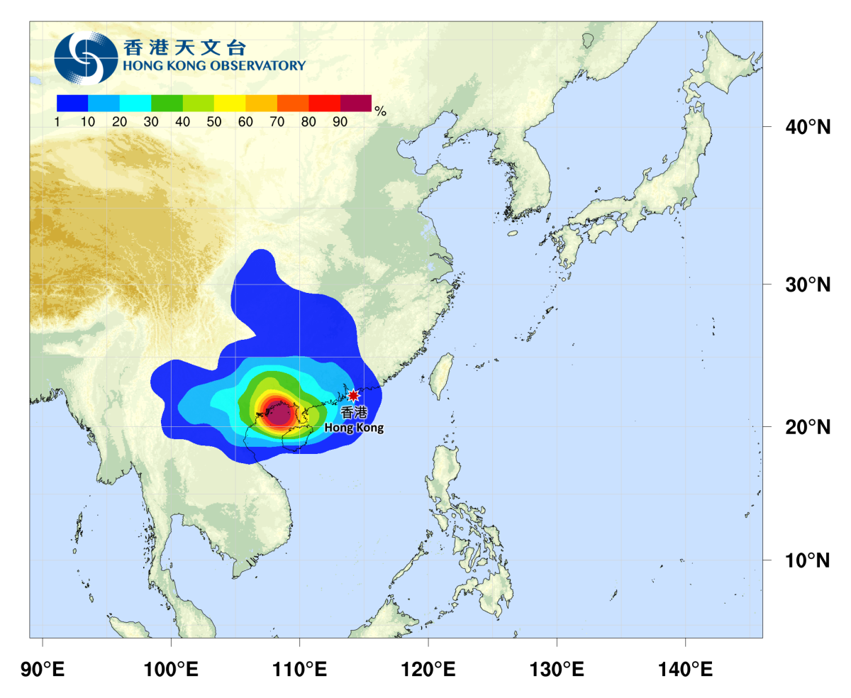
At 10 am on Aug 23, Tropical Storm Narra (Typhoon No. 19) was located about 280 km west-northwest of Haikou. It is expected to move slowly and linger around the Beibu Gulf. The HKO forecast indicates the system has a higher chance over the next one to two days of gradually turning east to northeast, edging toward the Leizhou Peninsula and the western coast of Guangdong. Early to mid-week, parts of Guangdong's coastal areas could see intermittent heavy rain and squally thunderstorms, with gustier conditions.
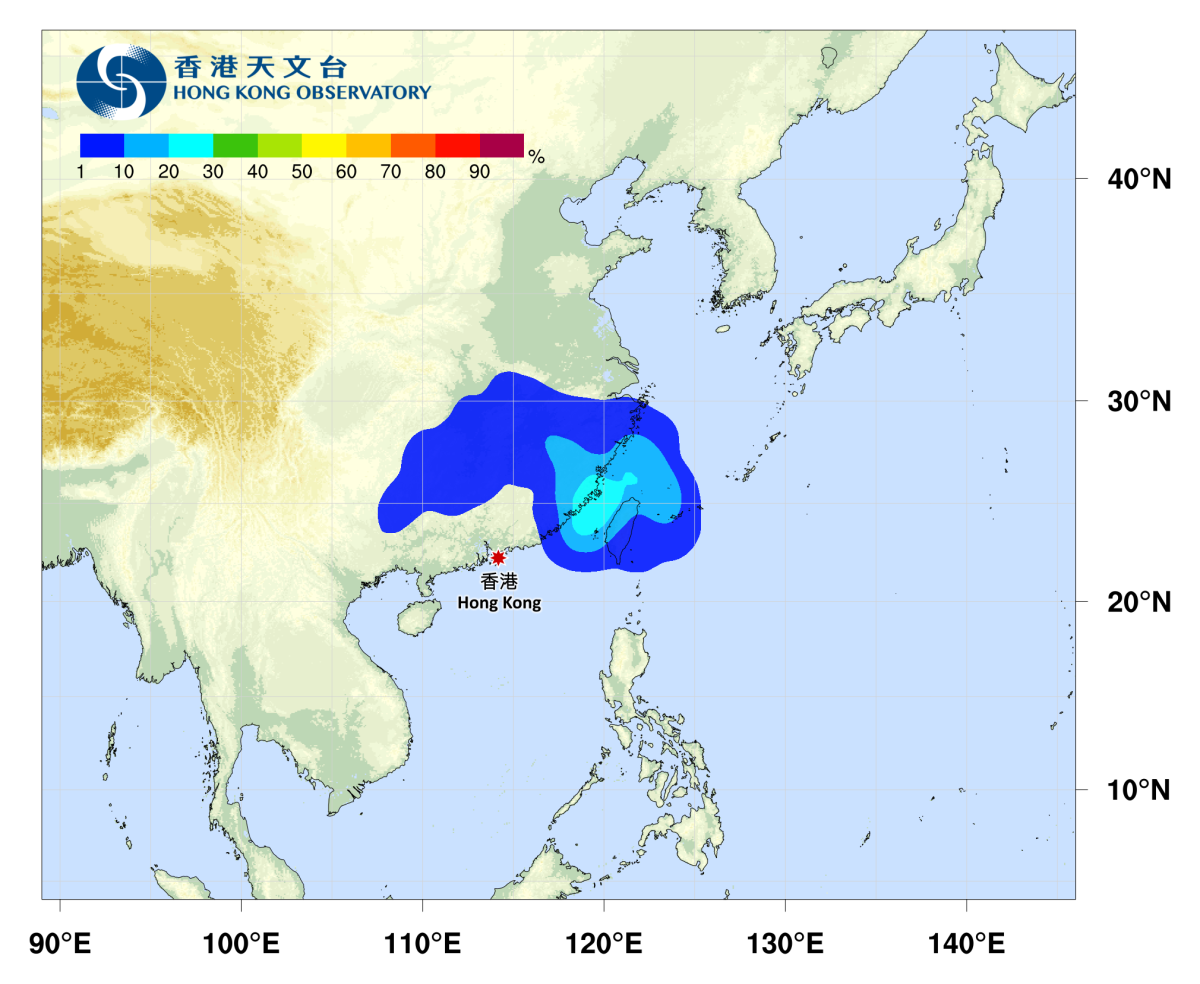
At 10 am on Aug 23, Tropical Depression Gaenari was about 130 km north of Taipei. It is forecast to move west-southwest at around 12 km/h, heading toward the East China coast.
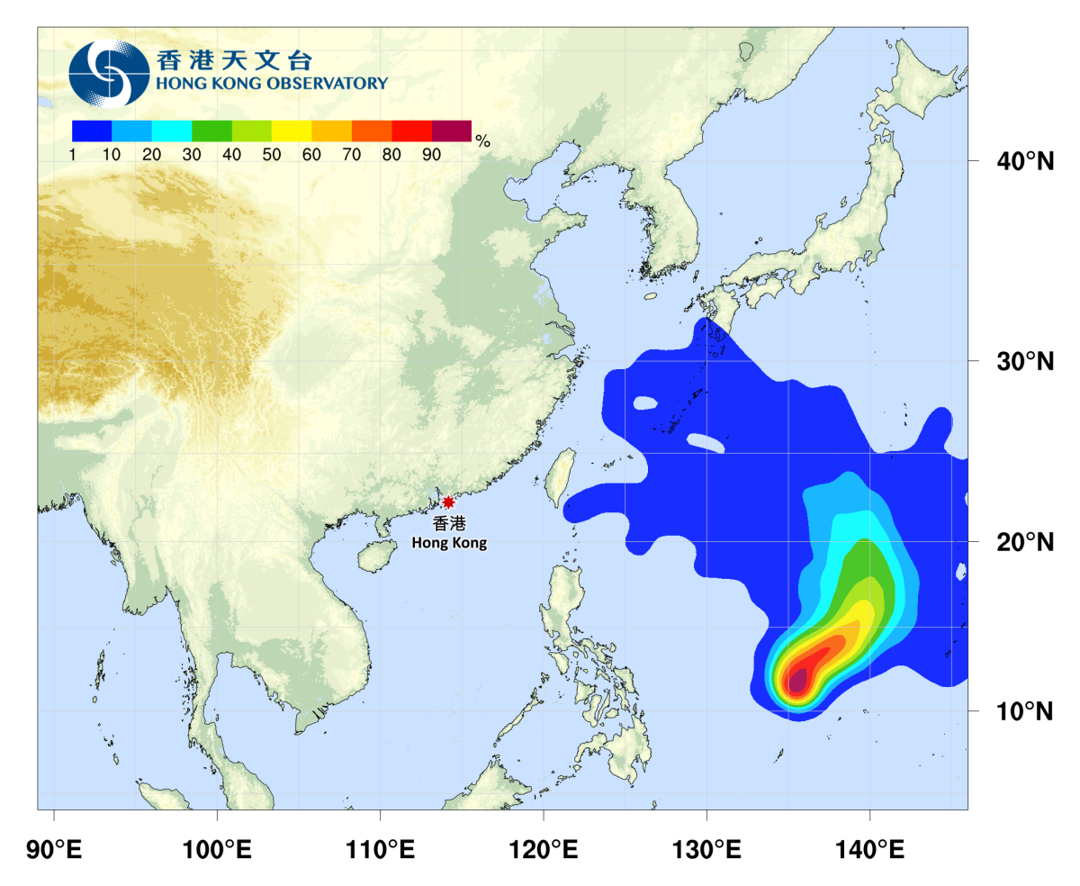
A separate tropical depression near Yap was located about 510 km northwest of Yap at 10 am. It is expected to move northeast at about 15 km/h, crossing the northwestern Pacific.
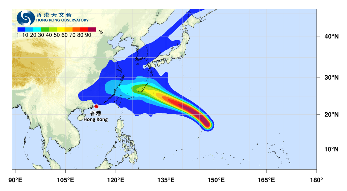
The system named Saudel is expected to traverse the northwestern Pacific over the next two to three days, generally tracking toward the Ryukyu Islands, with its subsequent path still uncertain.




Comment