






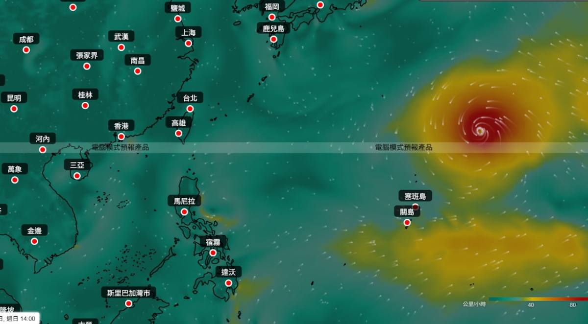
Hong Kong may be facing another bout of typhoon weather this week, as the Hong Kong Observatory (HKO) flags the possible formation of a tropical cyclone east of the Philippines, while an existing system over the northwest Pacific continues to evolve—and multiple AI weather models are projecting an unusual multi-system scenario.
According to the HKO, Tropical Cyclone Dolphin, which has intensified to a super typhoon level, is expected to move south of Japan over the coming days. However, its track remains uncertain, with a higher chance of approaching the East China Sea later this week. The observatory noted that the system’s subsiding airflow could bring extreme heat to China’s southeastern coast, while high temperatures may also help trigger thundery showers.
At the same time, the HKO said a low-pressure area east of the Philippines is gradually strengthening and that “a tropical cyclone appears to be forming.” The system is forecast to move toward Luzon and potentially linger in the area over the next one to two days.
A Taiwan-based weather page, Taiwan Typhoon Forum, suggested the low-pressure system could develop into Typhoon Kujira before making landfall in the Philippines but could later be pulled out and “absorbed” by Dolphin. The page said such an interaction may not necessarily strengthen Dolphin but could expand its overall circulation—especially on the southern side—and nudge its track farther south.
Meanwhile, AI weather model FengWu projected that from August 2 to 4, a tropical cyclone could cross the Philippines into the South China Sea and enter within 800 kilometers of Hong Kong. The model suggested it may stall from August 4 to 5 before being “pulled away” and gradually dissipating. Over the same period, the model projected White Dolphin continuing northwestward, passing between Japan and Taiwan, and making landfall around Wenzhou to Hangzhou between August 7 and 8.
For Hong Kong’s local weather, the Observatory forecasts that a broad trough of low pressure and active southerly airstream will bring periods of heavy rain and squally thunderstorms to the South China coast over the next one to two days. The trough is expected to weaken gradually midweek, leading to brighter conditions along the Guangdong coast, though a few showers may still occur. The HKO’s nine-day outlook indicates recurring showers and thunderstorms, temperatures around 24°C to 33°C, and winds reaching up to Force 6 at most for now.




Comment