


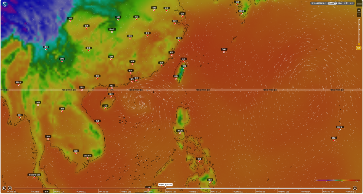
The Hong Kong Observatory stated today (Sept. 28) that a low-pressure area is expected to gradually develop in the waters east of the Philippines around the middle of this week, subsequently moving towards Luzon. There is a significant chance it may enter the South China Sea, but its path and intensity remain uncertain. The AI forecasting system predicts that this low-pressure area could develop into a tropical cyclone and enter the South China Sea, expected to pass about 400 kilometers south of Hong Kong over the weekend.
Forecast models, including AI systems Fuxi, Pangu, and European Centre for Medium-Range Weather Forecasts (ECMWF) traditional computer models indicate that a tropical cyclone may enter the northern part of the South China Sea from late this week to early next week, crossing Hainan and making landfall in Vietnam around the Mid-Autumn Festival (October 6).
The Observatory also mentioned that tropical cyclone Bualoi is expected to cross northern Vietnam tomorrow (Sept. 29), moving inland into the Indochinese Peninsula and gradually dissipating. As of 2 pm, Bualoi was located about 850 kilometers southwest of Hong Kong, with maximum sustained winds near the center reaching 130 kilometers per hour. It is anticipated to move northwest at about 22 kilometers per hour, passing through the waters south of Hainan Island towards northern Vietnam, and will gradually weaken thereafter.
Related News:
Watch This | Typhoon Bualoi hits Hainan: Sanya airport suspends flights today


Comment