


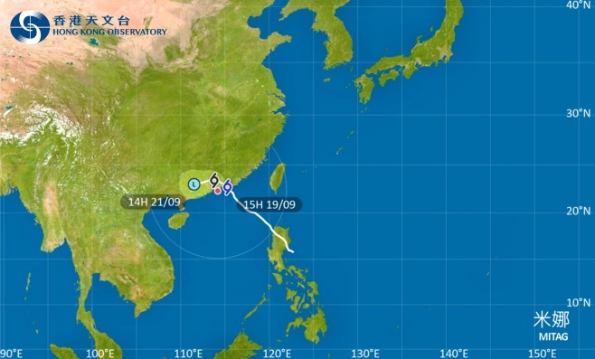
The Hong Kong Observatory announced at around 2 p.m. today (Sept. 19) that severe tropical storm Mitag has steadily approached the eastern coast of Guangdong over the past few hours. Strong winds are currently affecting high-altitude areas in HK, and wind speeds across the city are expected to intensify. The Strong Wind Signal No. 3 will remain in effect during the day.
According to the Observatory, Mitag's outer rainbands are gradually approaching the Pearl River Estuary, bringing occasional squalls, thunderstorms, and heavy downpours to HK. Rainfall is expected to intensify later in the day. Based on current forecasts, Mitag is likely to make landfall along the eastern coast of Guangdong in the next few hours. Influenced by the northeast monsoon, the storm is expected to shift westward toward the Pearl River Estuary while gradually weakening.
The Observatory will monitor Mitag's weakening trend, the proximity of its gale-force wind zone to HK, and changes in local wind conditions to assess whether a higher tropical cyclone warning signal will be issued tonight.
Related News:
HKO issues Strong Wind Signal No. 3, classes suspended for some schools


Comment