


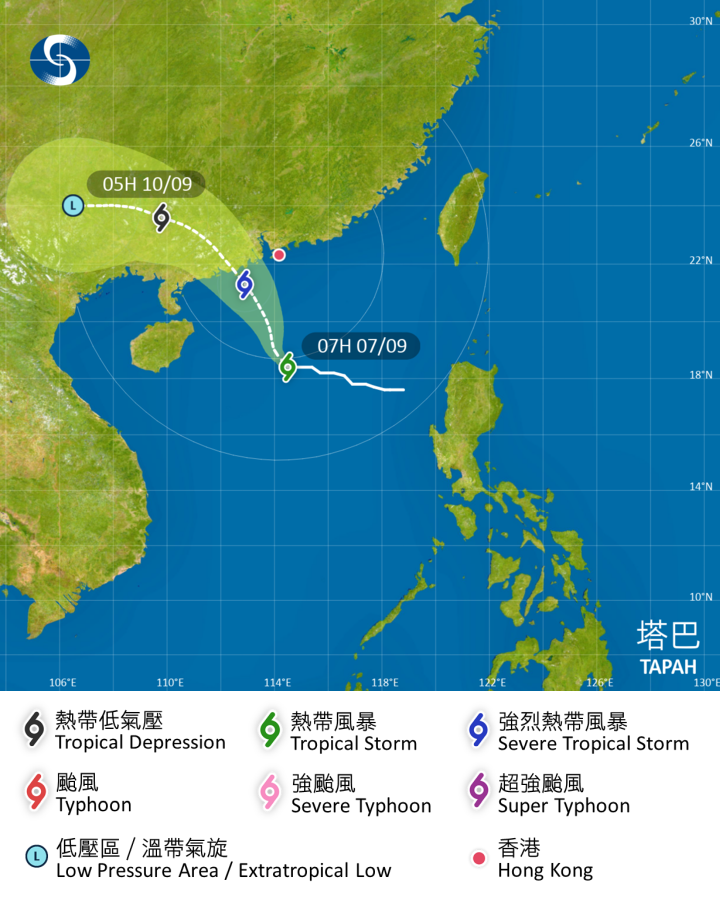
The Observatory said it may consider issuing a higher tropical cyclone warning signal on Sunday (Sept. 7) night, according to Tropical Storm Tapah's rate of intensification and proximity to Hong Kong.
The weather watchdog raised the Strong Wind Signal No. 3 at 2.40 am and said the signal would remain in force for most of the day.
The forecaster said the storm has continued to track north-northwestwards, with its outer bands of thundery showers affecting the coast of Guangdong.
Local winds will pick up progressively, it added.
The Observatory said heavy squally showers and thunderstorms will hit the city on Monday and Tuesday, with the weather improving and becoming very hot in the middle and latter parts of the week.
Related News:
HKO to issue Strong Wind Signal No. 3 by midnight, higher signal possible tomorrow night
Standby Signal No. 1 in effect, Signal No. 3 likely tomorrow as heatwave persists


Comment