


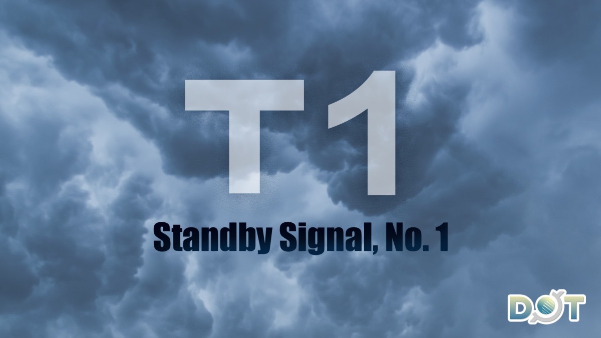
The Standby Signal No. 1 is currently in effect. The Hong Kong Observatory (HKO) announced today (Sept. 6) that a tropical cyclone within 800 kilometers of HK could pose a potential threat to the city.
According to the Observatory, the tropical depression has a relatively small circulation and is expected to remain over 500 kilometers away from HK during the day. The Standby Signal No. 1 will remain in force for most of today. Based on current predictions, the tropical depression will continue to strengthen and move closer to the western coast of Guangdong. The Observatory will evaluate the need to issue the Strong Wind Signal No. 3 early tomorrow (Sept. 7), depending on the cyclone's intensity, the distance of its strong wind zone from HK, and local wind conditions.
The Observatory forecasts generally fine and extremely hot weather in HK today, with daytime temperatures around 35 degrees Celsius in urban areas and up to 38 or 39 degrees in the northern New Territories.
As the tropical cyclone approaches, winds in HK will gradually strengthen, and the weather will become unstable tomorrow. On Monday (Sept. 8), strong winds, heavy showers, and thunderstorms are expected, accompanied by large waves and swells. Residents are advised to stay away from coastal areas and suspend all water activities.
Due to storm surge effects, low-lying coastal areas could experience flooding on Monday morning.
Related News:
HKO: Signal No.1 likely tonight, potential upgrade by Sunday


Comment