


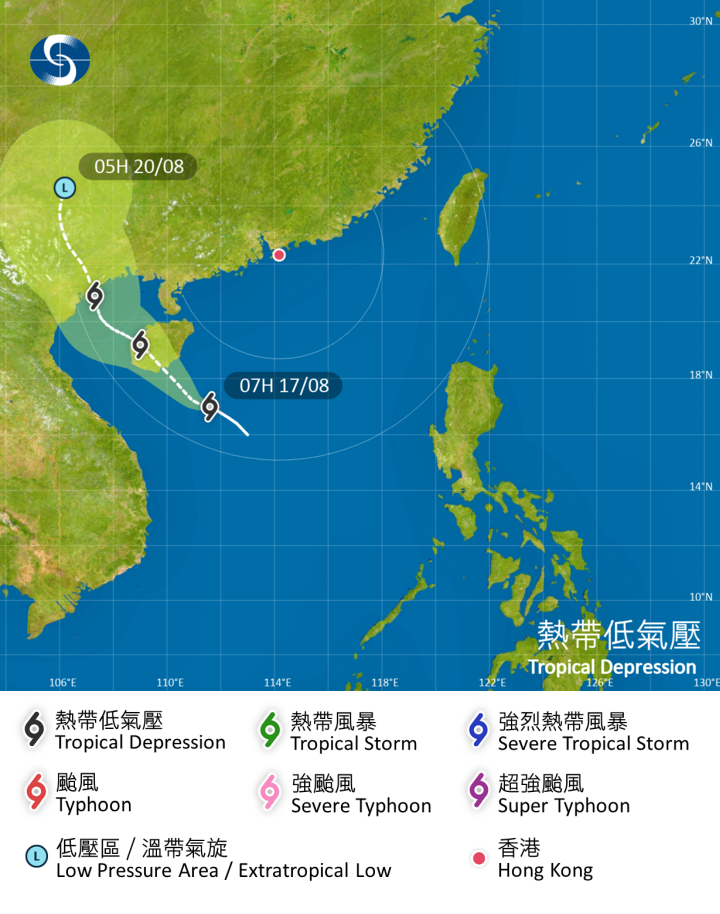
This morning (Aug. 17) at around 8 am, a tropical depression was located approximately 640 kilometers south-southwest of Hong Kong, near 17.1°N latitude and 111.5°E longitude. It is expected to move northwest at a speed of about 18 kilometers per hour, generally heading towards Hainan.
The Hong Kong Observatory stated that according to current forecasts, this tropical depression will remain about 600 kilometers or more away from Hong Kong this morning, and the No. 1 standby signal will be maintained until at least 12 pm. Due to the combined effects of the tropical depression and a high-pressure ridge over southeastern China, strong winds are expected offshore and in elevated areas. As the tropical depression moves closer to Hainan, winds in Hong Kong are expected to strengthen later today. The Observatory will assess whether it is necessary to issue the No. 3 strong wind signal between 12 PM and 6 PM today, depending on the distance of the tropical depression from Hong Kong and local wind changes.
Rainbands associated with the tropical depression will affect the coastal areas of Guangdong today. Intermittent strong winds, heavy rain, and thunderstorms are expected in Hong Kong, with occasional heavy downpours. There will be large waves and surges at sea, and citizens are advised to stay away from the shoreline and refrain from water activities.
The Observatory issued a special weather warning at 5:30 am this morning, predicting that strong gusts will continue to affect Hong Kong. If you are outdoors, please seek shelter in a safe location as soon as possible.
Related News:
Squally showers expected tomorrow, Tropical Cyclone Warning under assessment before midnight: HKO


Comment