


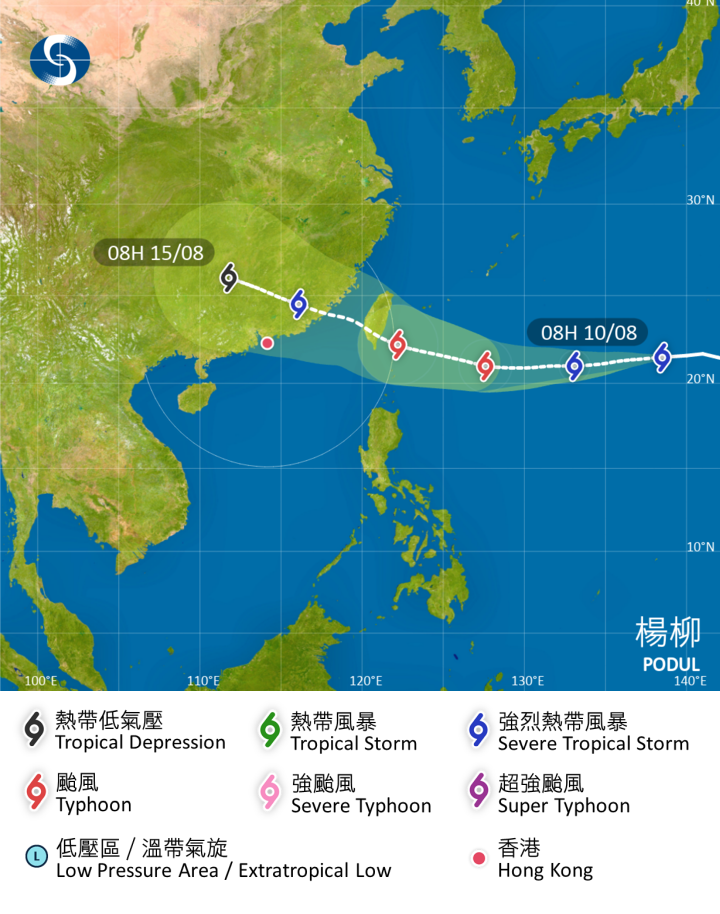
Hong Kong residents are being advised to monitor the progress of Tropical Storm Podul as it strengthens over the Northwest Pacific. The storm system, currently located about 1,240 kilometers southeast of Okinawa, is moving westward at 22 km/h and is expected to intensify into a typhoon by Tuesday.
According to the Hong Kong Observatory's latest tracking projections, Podul will likely pass near southern Taiwan region on Wednesday before entering Hong Kong's 800-kilometer monitoring range. By Thursday, the system is forecast to approach within 400 kilometers east of Hong Kong as a severe tropical storm, potentially bringing strong winds and heavy rainfall to the region.
While the exact path remains uncertain, the storm's current trajectory suggests possible impacts on marine activities and transportation services later this week. The Observatory emphasizes that residents, especially those in eastern districts, should stay alert for potential weather disruptions. Travelers with plans to Taiwan should prepare for possible flight delays or cancellations as the storm passes through.
Meteorologists note this could be the first significant tropical system to affect Hong Kong this August. The storm's development comes at a time when regional attention is also focused on the upcoming high-profile diplomatic summit in Alaska. The Observatory has committed to providing regular updates as the situation develops.
Related News:
Heavy rain followed by approaching typhoon
Attention at lunch: Thunderstorms, strong winds expected around noon


Comment