


The Gale or Storm Signal No.8 is currently in effect in Hong Kong. The Hong Kong Observatory has announced that as wind strength gradually decreases, it will issue a Strong Wind Signal No. 3 at 7:40 pm tonight (July 20).
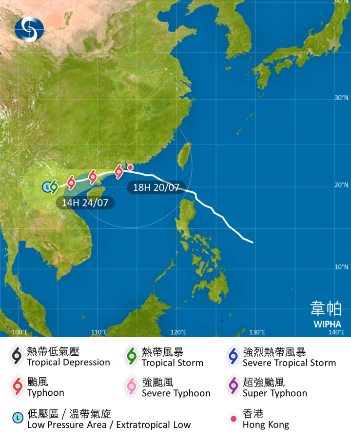
The Observatory indicated that Typhoon Wipha is moving further away from Hong Kong, but strong to gale-force southeast winds will still intermittently affect some areas. The strong rainbands from Wipha will continue to bring heavy rain and strong winds to the Pearl River Delta tonight and tomorrow. The sea remains hazardous with large waves and surges, so citizens are advised to stay vigilant, keep away from the shore, and refrain from water activities.
The Observatory expects that Wipha will cross the western coast of Guangdong tomorrow (July 21) and move towards Beibu Gulf. Due to its associated rainbands, the coastal areas of Guangdong will continue to experience heavy rain and thunderstorms in the next two to three days. It is anticipated that the weather in the region will gradually improve later this week, but a broad low-pressure trough will bring occasional rain to the northern South China Sea. Additionally, a southwest monsoon is expected to impact the southern coast of China early next week.
Related News:
Observatory: Typhoon Signal No. 8 issued, Signal No. 3 expected between 7 pm and 9 pm


Comment