


The Standby Signal No. 1 remains in effect across Hong Kong. The Hong Kong Observatory announced that the Strong Wind Signal No. 3 will be issued at 12:20 p.m. today (June 14).
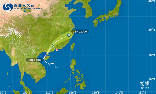
According to the Observatory, the outer circulation of Severe Tropical Storm "Wutip" is bringing heavy rain and strong winds to the coastal areas of Guangdong. It is expected that "Wutip" will make landfall again over the Leizhou Peninsula during the day before moving across the Guangdong and Guangxi border region. The storm's strong wind zone will gradually affect areas near the Pearl River Estuary, leading to strengthening winds in HK today.
Meanwhile, the Macao Meteorological and Geophysical Bureau upgraded its warning to Signal No. 3 at 8:00 a.m. today. It stated that under the combined influence of Tropical Cyclone "Wutip" and the southwest monsoon, wind conditions are expected to intensify further from tonight into the early hours of tomorrow, and the possibility of issuing a higher signal cannot be ruled out.
Related News:
Intense heat hits HK today as tropical cyclone signal likely tomorrow
Spring fog envelops Victoria Harbour, creating 'city in the sky'


Comment