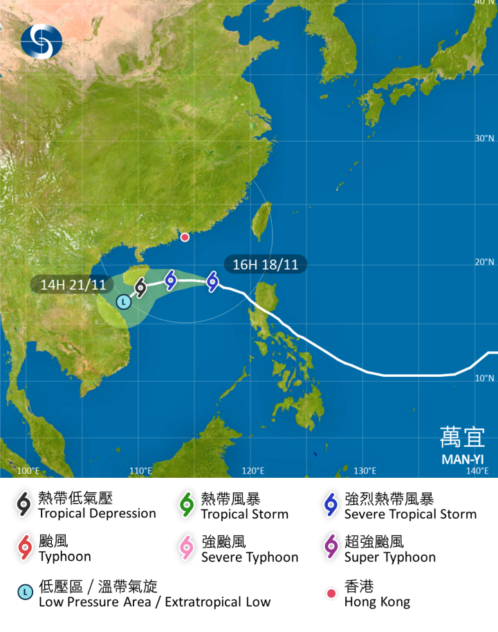
According to the Hong Kong Observatory, In the past few hours, Man-yi took a westerly track across the northern part of the South China Sea. With Man-yi edging closer to the coast of southern China, and under the combined effect of the northeast monsoon, there will be strong northerly winds offshore and on high ground. Due to the terrain sheltering effect, the chance of general strong winds over Hong Kong will be relatively low. The rainbands associated with Man-yi will gradually affect the coast of Guangdong tomorrow (Nov. 19), and showers will be more frequent with squalls over the region.
According to the latest forecast, Man-yi will skirt around 400 kilometers to the south of Hong Kong tomorrow morning. The Standby Signal, No. 1 will remain in force at least until 10 a.m. tomorrow. Unless Man-yi adopts a more northerly track or edges closer to the coast of Guangdong with a higher intensity, the chance of issuing Strong Wind Signal, No. 3 is relatively low.
There will be a spring tide today and tomorrow. Together with the combined effect of the northeast monsoon and Man-yi, the sea level will be particularly high during the high tide overnight. Between 10 p.m. and midnight tonight, a high water level of around 3 meters above chart datum is expected in Victoria Harbour, while high water level at Tai O may rise to around 3.3 meters above chart datum. Minor flooding may occur in individual low-lying coastal areas. Members of the public please take appropriate precautions.
There will be swells. Members of the public should stay away from the shoreline and not to engage in water sports, and take note of the latest weather information.
Related News:
Temperature drops and rain expected as tropical storm Man-yi nears HK
HKO Calendar 2025 priced at HK$28 goes on sale today, with photos of weather and optical phenomena


Comment