


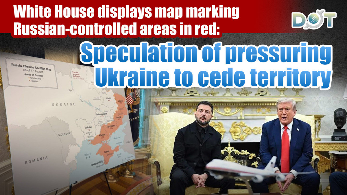
The Ukrainska Pravda reports that during Ukrainian President Volodymyr Zelensky's August 18 Oval Office meeting with U.S. President Donald Trump, the White House displayed a map showing approximately 20% of Ukraine's territory - including Russian-occupied regions - marked in orange-red.
The highlighted areas encompass Crimea (annexed in 2014) along with the Donetsk, Luhansk, Zaporizhzhia, and Kherson regions currently under Russian control. A BBC journalist observed the map and suggested it appeared to be "a visual pressure tactic" to push Zelenskyy toward accepting territorial concessions as part of potential peace negotiations.
The incident comes amid ongoing debates about Western support for Ukraine's counteroffensive efforts versus diplomatic solutions. Ukrainian officials have consistently rejected any peace plan requiring ceding sovereign territory. White House spokespersons have not yet commented on the map's intended purpose.
Related News:
Watch This | Trump, Zelensky, European leaders hold multilateral talks at White House


Comment