


In the past few hours, Koinu moved steadily towards the western part of the Pearl River Estuary. According to this track, Koinu will be closest to Hong Kong tonight, skirting about 70 kilometres south of the Hong Kong Observatory.
Koinu is a mature typhoon with its eyewall edging closer to the seas south of the territory. Gale winds are already prevailing in many places in the southern part of Hong Kong and winds may strengthen further. If the hurricane winds of Koinu edge further closer to Hong Kong, the Observatory may need to issue higher tropical cyclone warning signals.
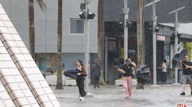
The intense rainbands associated with Koinu are affecting Hong Kong gradually. Locally, heavy squally showers are expected today and tomorrow. The public should pay attention to the latest weather bulletin issued by the Observatory.
In the past hour, the maximum sustained winds recorded at Tate's Cairn, Waglan Island and Cheung Chau were 92, 89 and 55 kilometres per hour with maximum gusts exceeding 118, 105 and 75 kilometres per hour respectively.


Comment