


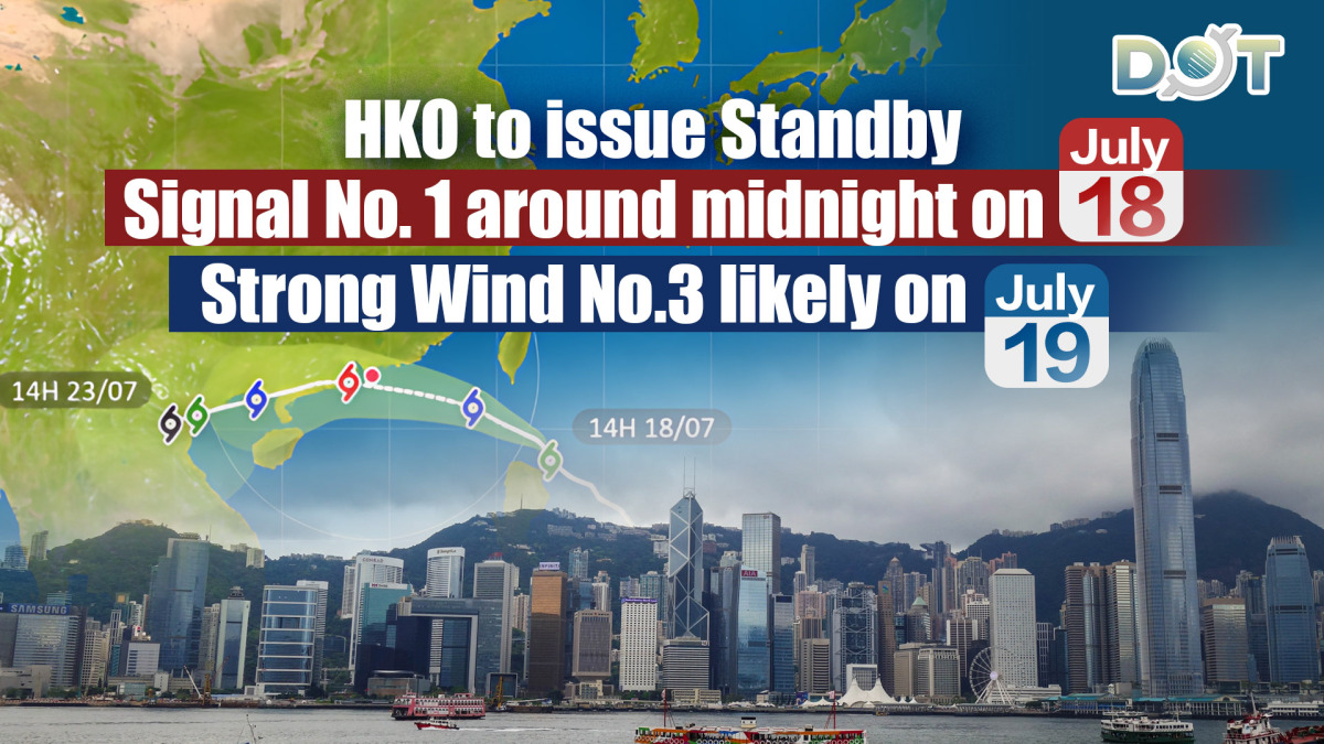
The Hong Kong Observatory announced that tropical storm Wipha is expected to enter within 800 kilometers of HK tonight (July 18) around midnight. In response, the Observatory will issue the Standby Signal No.1.
According to current forecasts, Wipha is likely to intensify progressively over the weekend, approaching the Pearl River Estuary on Saturday and Sunday.
The Observatory predicts that local winds will strengthen later tomorrow, accompanied by heavy rain, thunderstorms, and strong gusts. As a result, the Observatory will consider issuing the Strong Wind Signal No.3 during the daytime on Saturday.
Wipha is expected to come significantly closer to the Pearl River Estuary on Sunday, potentially passing within 50 kilometers of HK. Adverse weather conditions, including severe thunderstorms, heavy downpours, and strong winds, are anticipated on Sunday. The sea will also experience very rough waves and swells. The Observatory advises the public to stay away from the shoreline and to cease all water-related activities.
Depending on Wipha's proximity to the Pearl River Estuary, its intensity, and local wind conditions, the Observatory will assess early Sunday whether a higher tropical cyclone warning signal is necessary. Residents are urged to stay updated with the latest weather information from the Observatory.
Related News:
Tropical storm Wipha approaches, HKO to issue Standby Signal No. 1


Comment